BUCKLAND NEW BALTIMORE VINT HILL BROAD RUN
(To View the History of a specific region, click on the link above to jump to that area’s history on the page.)
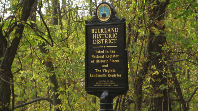
BUCKLAND CIVIL WAR BATTLEFIELD & HISTORIC DISTRICT
The Battle of Buckland Mills, also known as The Buckland Races or Custers Second to Last Stand, was fought on October 19, 1863, between Union and Confederate forces in the American Civil War. Union cavalry led by Brig. Gen.Judson Kilpatrick and Brig. Gen. George A Custer were caught in a Confederate ambush and defeated.
Near Buckland Mills, on Broad Run, Confederate cavalry commander Maj. Gen. J.E.B. Stuart, with Maj. Gen. Wade Hampton’s cavalry division, were covering Gen. Robert E. Lee‘s retirement from his defeat at Bristoe to the Rappahannock River. On October 19, they turned on Kilpatrick’s pursuing Federal cavalry, while Maj. Gen. Fitzhugh Lee‘s division charged the Federal flank. Kilpatrick was routed, fleeing five miles to Haymarket and Gainesville. The Confederates derisively called the affair “The Buckland Races”, although some Confederate commanders likened it to a fox hunt. Read an excerpt from a soldier referencing the attacks HERE.
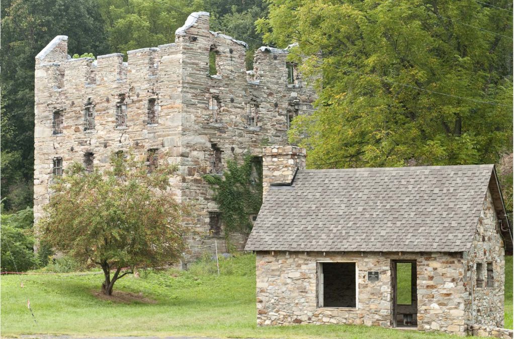
Buckland is a humble place by modern standards. Understanding its history, significance, potential, and purpose is more complex. The Town of Buckland, located at US 29 and US 15 at the confluence of the Broad Run in western Prince William County, was chartered in 1798 during which 48 town lots were created. The Prince William County Historic Overlay District encompasses 15 of the district’s 46 contributing resources. A much larger area of Buckland is listed on the Prince William Counties’s Register of Historic Sites, the Virginia Department of Historic Resources, and the National Historic Register which include the Town and surrounding plantations and a civil war battlefield. The Town survives as one of the best preserved 18th and early 19th century industrial towns in Virginia. In addition, Buckland includes significant histories based on pre-historic artifacts, commerce, civil war military engagements, as well as African-American and Black Freedman contributions.
THE VILLAGE OF NEW BALTIMORE
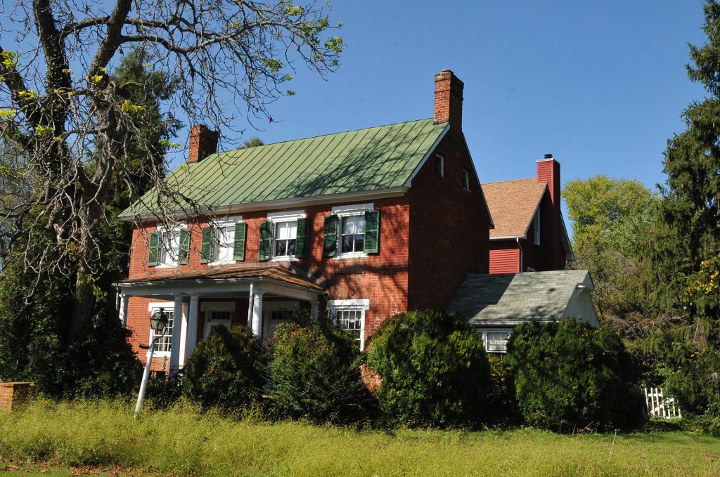
Located just north of Route 15/29 and east of the Snow Hill neighborhood, the Village of New Baltimore holds a valued, historic place in this area’s overall development. The Village is on both the Virginia Landmarks and National Register of Historic Places. It is situated at the base of Pond Mountain, at the junction of the old road from Warrenton to Alexandria (know as Old Alexandria Turnpike) and two smaller roads that wrapped around Pond Mountain to Thoroughfare Gap (Rt. 674: Georgetown Road and Rt. 600: Beverly’s Mill Road). The Village encompasses approximately 88 acres and includes 25 properties and 56 contributing buildings, with the majority of buildings ranging in date from the 1820’s to the mid-20th century. The front portion of the Kube Farm, extending from the intersections of U.S. 15/29 with Old Alexandria Pike and Beverley’s Mill Road, is included in both registers and had land carved from its acreage to form portions of the village.
The James Hampton’s Tavern is the most prominent building (Circa 1823) with both the Marquis de La Fayette and President Andrew Jackson making stops. During the Civil War and due to its strategic location of major roads, New Baltimore was often the scene of troop movements. The original Broad Run Baptist Church, located outside the historic area designation, was apparently burned by Federal troops, destroying a century old landmark of the community.
New Baltimore was first known as Ball’s Mill or Ball’s Store. William Ball was the owner of a both a mill and a store and also served as an agent for the Niles Register, a Baltimore, Maryland Newspaper. It is speculated that the name of the village derived from Ball’s association with the Maryland city newspaper.
Much of the land on which New Baltimore is located, along with a number of substantial surrounding tracts, were owned by William Hunton and his family who came to Fauquier from Lancaster County, Pennsylvania, in the mid-18th century.
In the town’s heyday in 1835, it boasted 17 dwelling houses, 2 mercantile stores, a tan yard, wheelwright, blacksmith, boot and shoe factory, and two wheat fan factories.
VINT HILL HISTORIC DISTRICT
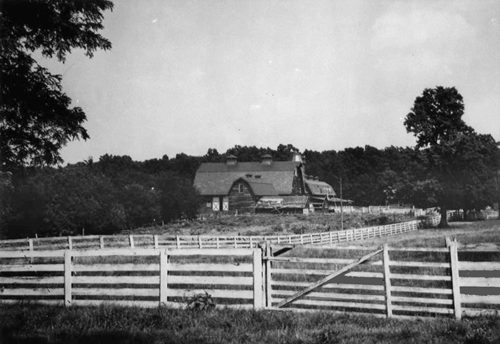
With the first deed for the property appearing in 1772, ownership of this 700+-acre plot changed hands and purposes several times as the centuries rolled by. It went from a sheep and cattle farm, to a favorite location for John “Gray Ghost” Mosby to agitate Union Troops in the area during the Civil War, to a charming country estate and finally to Vint Hill Farms Station. VHFS was established during World War II in 1942 by the Army’s Signal Intelligence Service (SIS). The facility was built because the Army needed a secure location near SIS headquarters, to serve as a cryptography school and as a refitting station for signal units returning from combat prior to redeployment overseas. It served as a World War II intelligence gathering station and was one of the United States’ most important during the war, playing a pivotal role in eavesdropping on enemy communications. In 1943, the VHFS intercepted a message from the Japanese ambassador in Berlin to his superiors in Tokyo. General Dwight D. Eisenhower later said the information in that message made a significant contribution to the D-Day invasion at Normandy.
The state level Vint Hill Economic Development Authority (EDA) was established in 1999 by the Commonwealth of VA to attract public and private businesses to the former military base. With state’s leadership, and over $10,000,000 of VDOT grants for upgrading the old base roads to state standards, Fauquier County transformed the base into the thriving housing and business community that it is today.
BROAD RUN
Broad Run is a small, unincorporated community in Fauquier County, Virginia. It is on Bust Head Road just north of Interstate 66 and State Route 55, near the Prince William County line. Broad Run is named after the waterway that flows through the town. Broad Run has its own ZIP Code of 20137, and its post office serves a population of 1,510.
The town of Broad Run was a thriving community in the late 19th century and early 20th century. The decline of the railroads spelled the demise of the town, and all that is left of the town proper is less than five homes from that period, and a few stone foundations and chimneys for buildings that no longer exist. A ramp for loading freight trains still exists on the still active Norfolk Southern freight line, but is covered with weeds and in such disrepair as to be no longer useful. The most notable historical site in Broad Run is Chapman’s Mill, a.k.a. Beverley’s Mill, which can be found two-thirds of a mile ESE from the center of the town of Broad Run. The Battle of Thoroughfare Gap, a seemingly inconsequential but eventually very important battle of the American Civil War, was fought at Chapman’s Mill. The Battle of Thoroughfare Gap, also known as Chapman’s Mill, took place on August 28, 1862, in Fauquier County and Prince William County, Virginia, as part of the Northern Virginia Campaign of the American Civil War. Confederate forces under Maj. Gen. James Longstreet successfully drove back Union forces under Brig. Gen. James B. Ricketts and Col. Percy Wyndham, allowing his corps to unite with that of Thomas J. “Stonewall” Jackson prior to the Second Battle of Bull Run (Second Manassas).
In terms of casualties, the battle was small, with only 100 combined, but had major strategic consequences. Ricketts failed to fully comprehend the importance of keeping the two wings of the Confederate army apart. Rather than entrenching his force in a strong defensive position at the gap, the easiest and quickest crossing of the Bull Run Range, he left only cavalry there while he sat a half-day’s march away at Gainesville, protecting the railroad, a job much more suited for his cavalry. As such, he lost the advantage and the only hope his small force had in seriously hindering Longstreet’s advance. His failure to do so allowed the two wings of the Confederate army to unite at Manassas and virtually ensured Pope’s defeat during the Second Battle of Bull Run on August 29.The Thoroughfare Gap Battlefield and Galemont are listed on the National Register of Historic Places.
The Broad Run postal area is an almost exclusively residential area which is mostly in Fauquier County, Virginia, with the northeast section in Prince William County. The few businesses that can be found in the Broad Run postal area are generally home businesses or agricultural businesses. Notably, Sharkawi Farms grows a wide variety of spices that are sold locally and Meriwether Vineyard is home to Pearmund Cellars Winery. The Broad Run postal area, at its southern edge, also contains what was historically the town of New Baltimore. Much of what is currently considered the modern-day New Baltimore is not in the Broad Run postal area.
Several old building foundations and graveyards may be found in the large wooded areas in the Broad Run postal area, some dating back over 200 years.